|
Hiking
the Cariboo Chilcotin Coast

Trails
in this area. 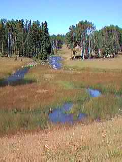
Snow capped
mountains, steep carved fiords, lakes large and small, rushing rivers
and bubbling brooks, cascading waterfalls, open grasslands, pine, spruce,
hemlock and cedar forests and rolling hills, all these different landscapes
are part of the Cariboo Chilcotin in central British Columbia.
This very
diverse region is bordered to the east by the Cariboo Mountains and the
Pacific Ocean to the west. The mighty Fraser runs south through this region,
almost cutting it in half. On the east side of the Fraser lies the Cariboo
with it's many lakes and forests, to the west is the Chilcotin with miles
of rolling grasslands and over the Coast Range are the rain forests and
many deep inlets. Wilderness and adventures are everywhere. Here you can
go river rafting, fishing, horseback riding, rockhounding, gold panning,
hang gliding, kayaking, canoeing, mountain biking, hiking, cross country
skiing, dog sledding, down hill skiing, snowmobiling and bird watching.
The Cariboo
Chilcotin is a true adventure vacation land and yours to enjoy.
Williams
Lake River Valley:
Williams
Lake River Valley Trail is a 14 km (9 mi.) hiking trail that takes
you from down town Williams
Lake to the Fraser River. This is a very interesting family hike that
takes you through different ecosystems and provides excellent scenery.
Ts'yl-os
Provincial Park:
Deep in the
Chilcotin, is Chilko
Lake surrounded by mountains and magnificent scenery that is part
of the Ts'yl-os Provincial Park where there are numerous hiking trails
At the north end of the lake, from the forest campsite, there is a hiking
trail that will take you up Tullin Mountain.
Tchaikazan-Yohetta
Trail:
A popular
back country hike is the Tchaikazan-Yohetta trail, this four to six day
trek is well used by hikers, hunters and horseback riders. Heading west
through the Tchaikazan Valley then back through the Yohetta Valley, the
trail is linked by going over Spectrum Pass and by Dorothy Lake. From
the trail are several other hiking adventures you can enjoy. This is remote
country, so be ready for the unexpected and always keep safety in mind.
To access this part of the Chilcotin, take Highway
20 west from Williams Lake, at Hanceville go south on the Chilko Lake
Road, it's a two to three hour drive on dirt road. A better way into Chilko
Lake, is Highway 20 west toTatla Lake, from here head south on the
Tatlayoko-Chilco Lake Road.
Rainbow
Range:
Hiking in
the Rainbow Range is an experience that will long be remembered, mostly
because of the beauty and solitude found here. These volcanic mountains
are aptly named with streaks of red, yellow and magenta. Mostly above
treeline, the hiking routes here are unlimited as you make your way from
ridge to ridge, with lakes and meadows and good camping sites. There are
no services here, so be well equipped and experienced in wilderness back
country hiking. From Williams
Lake head west on Highway 20 to Heckman Pass, shortly after the parking
lot, take the road for Octopus Lake which is the trail head into the Rainbow
Range.
Hunlen
Creek & Falls:
Located in
Tweedsmuir Provincial
Park's southern portion is Hunlen Creek and Hunlen Falls, which is
accessible only by plane or a two to three day one way hike. Highway
20, west from Williams
Lake will take you to Young Creek Picnic Site in Tweedsmuir
Park and the trail head. The Atnarko Tote Road is driveable for 13
km (8 mi.) if the vehicle is a four by four, but if hiking the complete
trail, make sure you have plenty of water, as there's none available along
the way. Once you reach Hunlen Falls and Turner Lake, there are other
trails to explore. Be very aware of grizzly bears in this area. Experience
and proper equipment are necessary, as you are in wilderness. Check with
park people for the latest trail condition and other information. Be safe,
have fun!
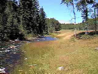
Blackwater
Canyon:
The
best way to see the Blackwater Canyon is on foot. There is a walking trail
that follows the canyon through lodgepole pine and beautiful flowers.
This is an excellent day hike from Quesnel.
Drive the Blackwater Road
west of Quesnel for 60 km (37 mi.) to the Blackwater River bridge and
the forest campsite. From here there is a so-called trail that leads to
the canyon rim. Be careful, do not go near the edges, they could easily
be undercut and break away under you.
For a unique and unforgettable back country hiking trek, follow the steps
of Alexander Mackenzie and his party and aboriginal guides and make your
way from the Fraser River by way of the Blackwater River to the Pacific
Ocean. This is the Alexander Mackenzie Heritage
Trail/Nuxalk-Carrier Grease Trail where only experienced hikers with
back country know how should venture.
No matter
what area in British Columbia you hike, always use your common sense and
never attempt a trail that is beyond your capabilities. Wildlife, especially
bears are everywhere, and there are cougars in certain areas of the province,
so be prepared.
Never harm
the fragile ecosystems, stay on the trails and pack all your garbage out.
The wilderness and adventures must be preserved so other generations will
be able to enjoy them.
Be safe,
have fun hiking B.C.
|